Cookie Consent by Free Privacy Policy Generator

Stanhoe Archive photos

Historic photos from the village of Stanhoe, Norfolk, UK

[ stop the slideshow ]

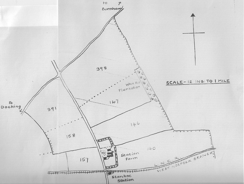
1896 Tenancy Map: Scale Plan of Station Farm, Stanhoe

Stanhoe_001581.jpg ThumbnailsMiss Annie Curson, later Mrs HoodThumbnailsMiss Annie Curson, later Mrs HoodThumbnailsMiss Annie Curson, later Mrs HoodThumbnailsMiss Annie Curson, later Mrs HoodThumbnailsMiss Annie Curson, later Mrs HoodThumbnailsMiss Annie Curson, later Mrs HoodThumbnailsMiss Annie Curson, later Mrs Hood

Thomas Henry Calver became the Tenant in October 1896. The farm covered 131 acres.

The dotted Parish boundary shows that part, falls into Docking Parish, (field nos 391 and 398,) but the rest are within Stanhoe Parish.

Chris Branch says in 2011:
"Whin Hill Plantation is marked but we called it "Top Wood". The woodland surrounding the farmyard we knew as "Station Wood" - a straight piece next to the railway line. The rest is in an "L" shape and we it called it "Back Wood."